
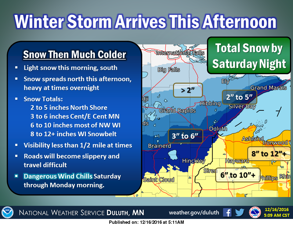
THE NATIONAL WEATHER SERVICE IN DULUTH HAS ISSUED A WINTER STORM WARNING FOR HEAVY SNOW...WHICH IS IN EFFECT FROM NOON TODAY TO NOON CST SATURDAY. *LOCATIONS...PORTIONS OF NORTHWEST WISCONSIN INCLUDING THE CITIES OF GRANTSBURG...SPOONER...AND HAYWARD.
Today
Snow. High near 13. South wind around 5 mph becoming east in the afternoon. Chance of precipitation is 100%. Total daytime snow accumulation of 1 to 3 inches possible.
Tonight
Snow. Patchy blowing snow after 4am. Low around 6. Blustery, with a northeast wind 5 to 15 mph becoming north after midnight. Winds could gust as high as 20 mph. Chance of precipitation is 100%. New snow accumulation of 3 to 7 inches possible.
Saturday
Snow likely before noon, then a slight chance of snow showers between noon and 1pm. Patchy blowing snow. Cloudy, with a temperature falling to around 0 by 5pm. Blustery, with a north wind 10 to 15 mph, with gusts as high as 25 mph. Chance of precipitation is 70%. New snow accumulation of less than one inch possible.
Saturday Night
Mostly cloudy, then gradually becoming mostly clear, with a low around -21. Wind chill values between -25 and -35. Northwest wind 5 to 10 mph.
Sunday
Sunny and cold, with a high near -6. West wind 5 to 10 mph becoming south in the afternoon.
Last Update: Dec 16, 2016 6:54 am CST


